Merestone
Statutory designations on one map, in the field, with no signal.
Get it on the App Store · Free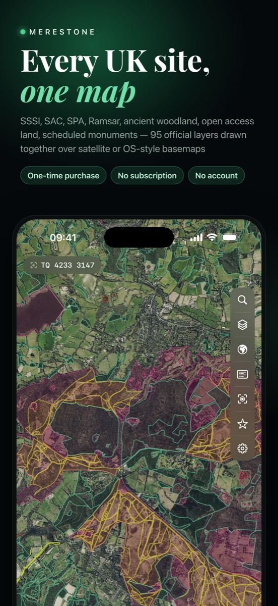
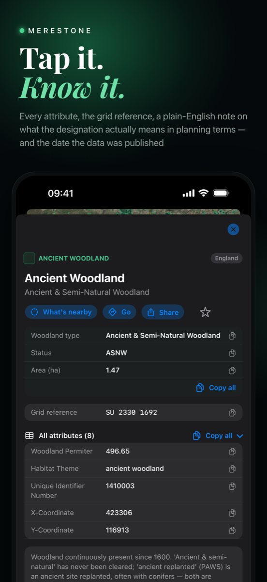
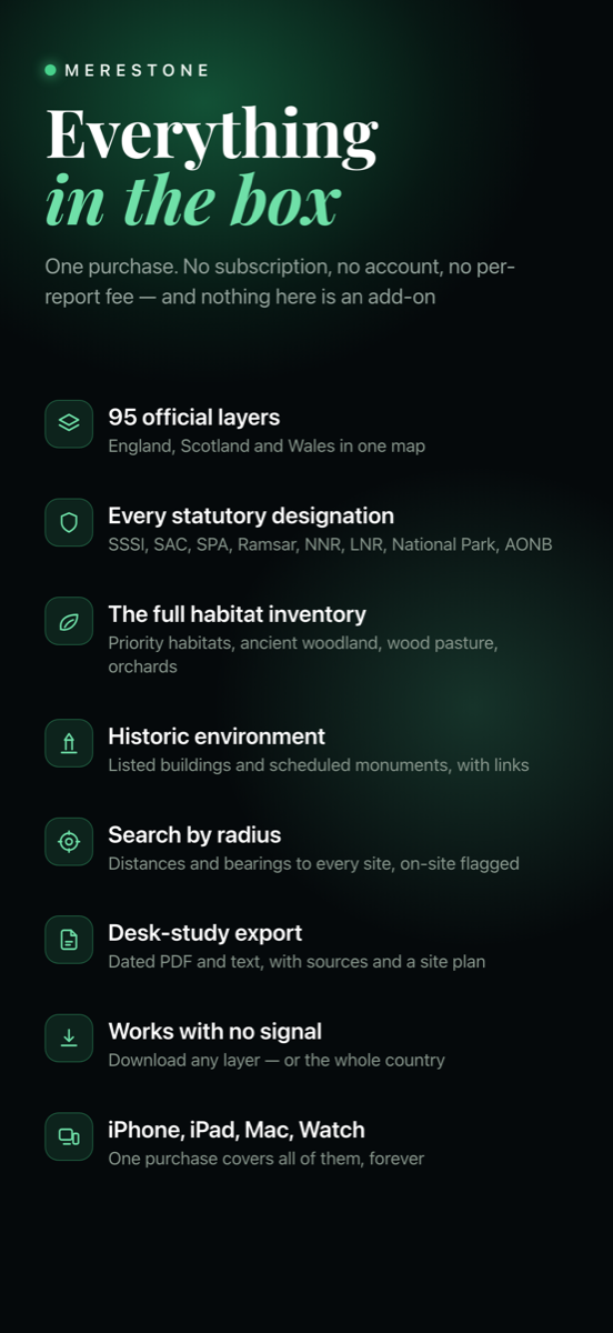
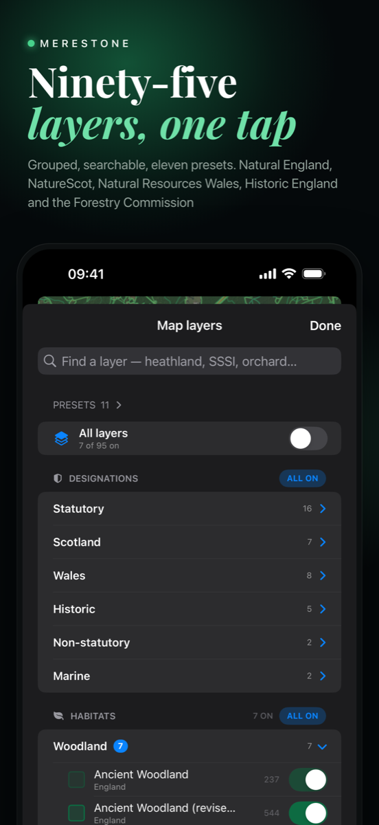
Merestone puts statutory environmental designations on one map, on your phone, in the field, with or without a signal. The United Kingdom first, then Ireland, France, Spain, Portugal, the Netherlands, Belgium, Germany and Switzerland, with each layer drawn from the agency that publishes it.
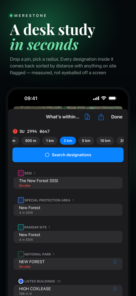
A desk study in seconds
Drop a pin, choose a radius, and every designation inside it comes back sorted by distance, with anything on site flagged. Distances and bearings are measured, not eyeballed off a screen.
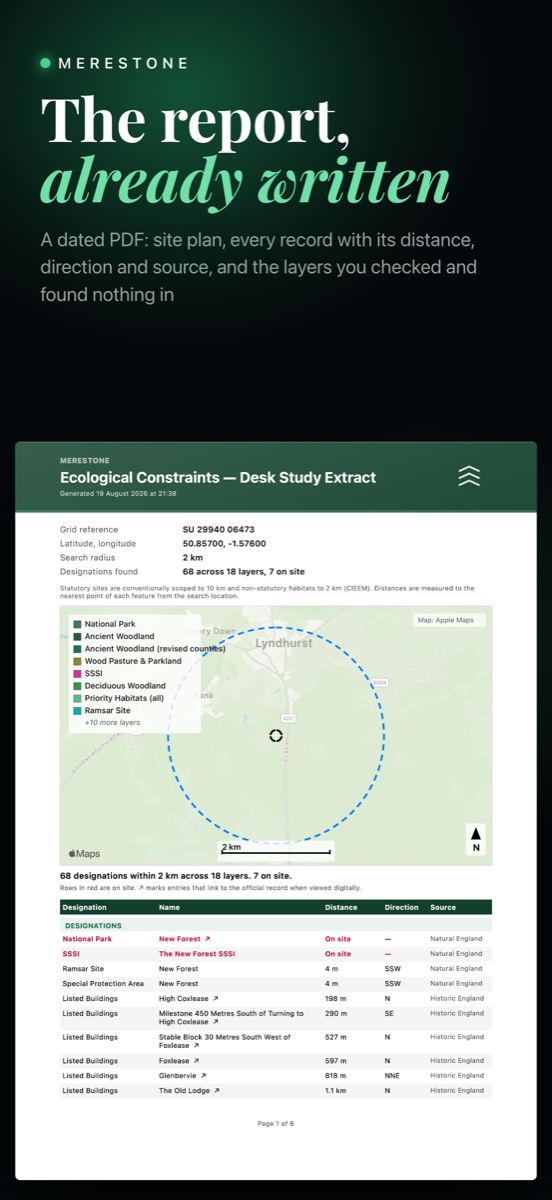
The report, already written
Export a dated PDF or text extract with a site plan, every record with its distance, direction and source, and just as importantly the layers that were checked and found nothing in. Choose which sections to include before you export.
What is on the map
- SSSI and SSSI Units, SAC, SPA and Ramsar sites, with ASSI in Northern Ireland
- National and Local Nature Reserves, National Parks and AONB
- Ancient woodland, the Priority Habitat Inventory, wood pasture and traditional orchards
- Open access land, listed buildings and scheduled monuments
- SAC, SPA, NHA and pNHA in Ireland, and Natura 2000 with each country's own designations in France, Spain, Portugal, the Netherlands, Belgium, Germany and Switzerland
- Live species records from GBIF, as a first look rather than an inventory
- England, Scotland, Wales, Northern Ireland, Ireland, France, Spain, Portugal, the Netherlands, Belgium, Germany and Switzerland, with the same map, searches and report throughout
Works with no signal
Unlock a country and download any of its layers, or all of them, and it keeps working out of signal. Merestone uses live data when you have a connection and falls back to your download when you do not, and it says which it used, on screen and in the report.
Built for the way the work happens
- Grid references in the system each country actually uses, and a search that accepts them
- Presets for desk study, woodland, wetland, coastal and species work, or save your own
- Favourites with notes, synced through your own iCloud, not through us
- An Apple Watch app for what is around you right now
Free to start, pay for the countries you use
Every country's statutory core and a 250 m search are free. Unlocking a country is a one-off purchase that covers iPhone, iPad, Mac and Apple Watch and never renews, and adds that country's full set of layers, wider searches, the PDF and offline downloads. A Merestone Worldwide subscription unlocks every country instead.
Get Merestone
Free to download, with every country's statutory core and a 250 m search free. Unlock a country once, or subscribe to Merestone Worldwide for all of them. No account needed, no analytics, no tracking.
Get it on the App Store · Free